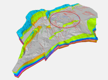
Development of a high-resolution 3D geological model and associated GIS-based subsurface data set for the FCC tunnelling work (FCC Geology 3D Model)
For the design of FCC trajectory, the subsurface geology that will be crossed by both the tunnel and the access shafts need to be known.
This project will focus on two major activities:
Establish a Geographic Information System (GIS)-based subsurface data set and data base architecture in support of the feasibility and execution of the FCC tunnelling work by defining a standard data set framework for new data and
Establish a consistent high-resolution 3D geological model, supported by quantitative geological analytical investigations along the FCC trace aimed at predicting geological features and possible risks in support of tunneling design, planning and execution.